LiDAR & Photogrammetry – Everything You Need To Know
There are several types of drone surveying, among which lidar and photogrammetry are the most popular ones. Today, we will talk about these two in complete detail.
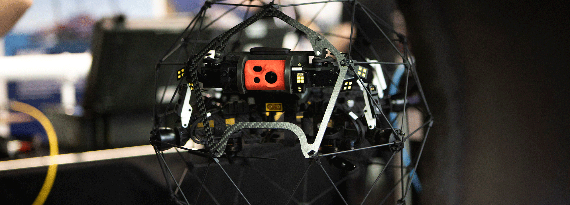
What Is LiDAR?
LiDAR, short for Light Detection And Ranging technology, functions by sending out light pulses and detecting how long it takes for them to reflect off the ground. It shoots out multiple lasers and measures the time taken for each beam to return to the detector. This data is then used to generate a cloud point by presuming the distance and angle of each lidar source point.
This lidar sensor is only one component of a very complex process. Lidar holds high-accuracy systems such as satellite positioning (GNSS data) and an inertial measurement unit (IMU) to gather data needed to build a cloud point.
Lidar surveying flights create 3D cloud points and intensity maps that generate valuable data useful for mining, forestry, agricultural and construction activities.
What Is Photogrammetry?
Photogrammetry captures high-resolution pictures to recreate a survey area and measure distances. These pictures are processed using highly specialised software to create realistic, geo-referenced, and measurable 3D models of the real world.
The 3D models created have a wide variety of usage in various fields – from construction planning to ongoing project management and marketing materials. Photogrammetry is also used to create 2D maps which provide accurate photo representations of an area with geo-referenced information.
Photogrammetry is a passive imaging technology that uses stitched images with key matching points and captured camera positions to conclude its outputs. It depends on reflected ambient light from the image surface. Because of this, the results are heavily affected by the time of the day, camera angle and cloud cover.
What Differs Photogrammetry From LiDAR?
The fundamental difference between lidar and photogrammetry is how they capture data. While lidar is a direct measurement technology that requires physically hitting a feature with light and measuring the reflection, photogrammetry uses images captured by a drone-mounted camera to remodel it in a highly accurate 3D model by using image overlap and ground control.
Lidar brings about point cloud-like images, while photogrammetry uses photos of the actual site and creates a fully 3D visual model of the object/surface.
When to Use LiDAR and Photogrammetry?
If you want to survey land with dense vegetation where light rays can still penetrate between branches and leaves, using lidar technology is your best bet. It provides an added advantage over drone photogrammetry, as it only produces sparse vegetation accuracy.
However, lidar technology has its limitations as well. It can only penetrate areas with 90% vegetation, whereas photogrammetry sits close at 60%. So if you work on sites with vegetation denser than 60%, lidar is a worth investing tool for you.
As you can see, all these benefits of lidar add to the fact that it is an excellent solution for the forestry industry. It is also great for surveying vast watershed scales through planes. Photogrammetry is better for broader surveying needs in mining, construction, and aggregates industries.
Pros of LiDAR
Are you still confused about what technology should you use based on your project requirements? Below we have listed a list of pros of lidar:
- Lidar is perfect for you if you aim for absolute accuracy while creating a realistic bare-earth model.
- As it is a direct measurement tool that combines GNSS data and fires hundreds of laser pulses, it ensures that your final digital terrain model has high vertical accuracy.
- Lidar is great if your job site does not have a consistent light condition. It can conduct night-time surveys and low-visibility operations without utilising an external light source.
- It allows you to collect small diameter details and accurately map wire catenary through high-density point sampling and direct measurement.
Pros of Photogrammetry
Although lidar has a list of benefits, you cannot underestimate the advantages photogrammetry provides you with. Here is a list of photogrammetry pros:
- Photogrammetry has simplified operations and made realistic maps and 3D models accessible to every company.
- It provides camera calibration, flight planning, drawing ground control points, completing a mapping mission and converting data into useful information.
- The results from photogrammetry can be made easily available.
- A major plus point of photogrammetry is its low cost. Getting started with it requires spending a few thousand dollars on a professional camera drone and a bit on the software needed to process your data.
- Photogrammetry allows you more flexibility to control trade-offs between mission speed, altitude, and accuracy depending on the task you have.
Factors to Consider While Choosing
Now that you are aware of the several benefits both lidar and photogrammetry provides, you need to consider some of the below factors while deciding which one suits your requirements.
- Consider the size of the object/surface you need to survey on
- Is the object going to stay still or move around while capturing?
- Consider the vegetation – Does it need to be removed?
- What are your required outputs? Models, colourised, 2D or 3D?
- The processing time, accuracy and setup costs
- Areas that need to be surveyed
Bottom Line
Over the period, both lidar and photogrammetry have become popular drone surveying techniques for collecting quality data and providing valuable insights. It is difficult to answer which one is the best because they add great value to their expertise.
 Author Bio:
Prior to starting Australian UAV (AUAV) James Rennie had a long career in natural resource management. In 2012 he identified a convergence of a previous hobby, radio controlled planes, and his passion for mapping data. Recognising this opportunity he established AUAV in early 2013, one of the first drone companies in Australia. With thousands of commercial flights completed, including in Antarctica, Armenia and throughout Australia, he manages the strategy and growth of the company.
Contact us to find out more about our fantastic range of different drones or any of our other inspection products, or request a quote online.
Carry on reading Case Studies: Elios 2 Inspection Drone Changing the Mining Industry to find out more.
